
Rail, Bus and Shuttle Services
Highway 288 entrance is within 1 mile of Gehring Place. This provides you quick and easy access to anywhere you need to be. It is also a straight shot downtown via Almeda.
See below for information on:
- Metro Bus, including stops and information for getting to Downtown and the Medical Center
- Metro Rail
- The Medical Center Shuttle
NOTE: the city has invested funds into widening the bridge across Brays Bayou at Almeda Road. This is currently impassable. For details on the project, including timing and detours, check out our Almeda Bridge Project page
Metro Bus
Houston Metro has many several stops in the area. The following chart shows information for using the bus to get to the Medical Center and to Downtown
Click here for bus schedule site
Click here for bus route map, including frequency of pickup (how often they come to a given stop)
Metro Bus-To The Medical Center: 004 - Beechnut
| Stop Number | Stop Name | Route Number | Route Name | Direction/ Bound | Distance to Bus Stop |
| 5447 | MacGregor Way @ Almeda Rd | 004 | Beechnut | Westbound | 0.4 miles |
| 9593 | Almeda Rd @ MacGregor Way | 004 | Beechnut | Eastbound | 0.3 miles |
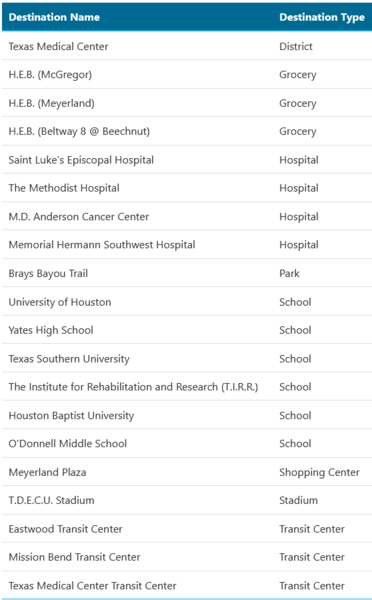
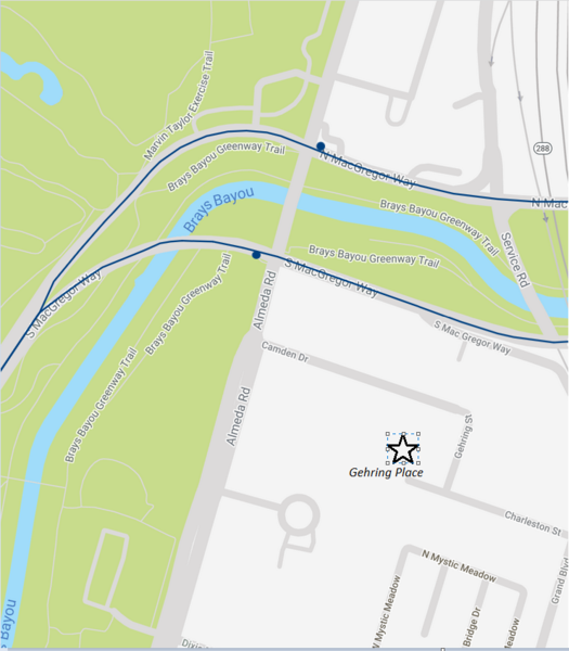
click on the images above to enlarge the Destination list or Map
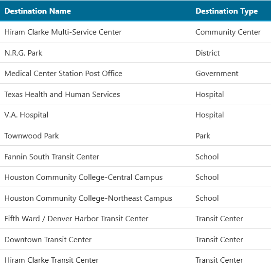
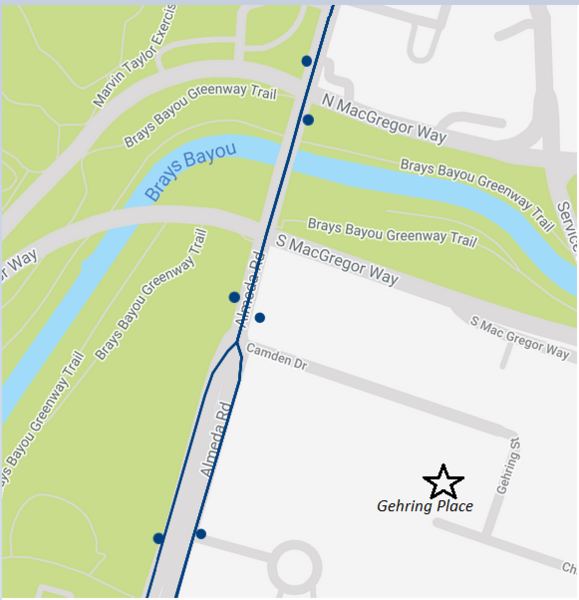
Metro Bus-To Downtown: 001 - Almeda/Lyons Line
| Stop Number | Stop Name | Route Number | Route Name | Direction/ Bound | Distance to Bus Stop |
| 9619 | Almeda Rd @ Camden Dr | 011 | Almeda/Lyons | Northbound | 0.14 miles |
| 9618 | Almeda Rd @ Dixie Dr | 011 | Almeda/Lyons | Northbound | 0.14 miles |
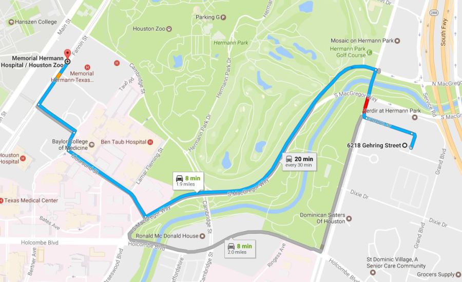
Metro Rail
The closest Metro Rail station is at Memorial Hermann Hospital/Houston Zoo. It is 1.5 miles from Gehring Place.
click on the images above to enlarge the Destination list or Map
The Medical Center Shuttle
Texas Medical Center’s (TMC) complimentary shuttle service provides convenient transportation for patients, visitors and employees within the TMC campus.